


How a major road project went ‘all digital’

25 August 2022
The Swiss municipality of Küsnacht has taken the principles of connected construction one step further on a road renovation project on the Schiedhaldensteig road.
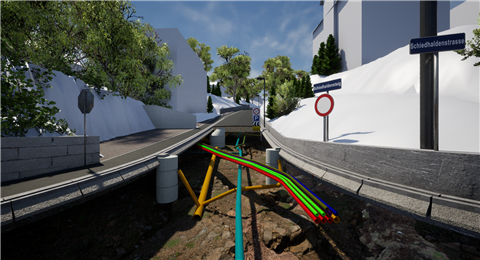
It tendered out the project as an all-digital Design and Build pilot project, encompassing everything from the initial surveying, through the renovation work on the road and sidewalk surfaces as well as the underlying services, down to the final as-built surveying. This included drainage, gas and water pipes and electricity lines. The aim was to learn how to best lay the foundation for the all-digital, data-enabled road maintenance process of the future.
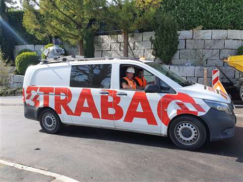
The Swiss department of Austrian construction giant Strabag won the tender and designed a workflow almost entirely based on Trimble technology. The contactor worked with Swiss Trimble distributor MEB Group, the parent company to construction technology partners SITECH and BuildingPoint Switzerland as well as ALLNAV, the local Swiss Trimble Geospatial solutions provider.
“Küsnacht wanted to get a clear understanding of the possibilities to bring lifecycle costs down on infrastructure maintenance projects,” says Stijepan Ljubicic, BIM Technical Group Leader, Strabag.
“Our client was adamant about getting the most technologically advanced solution for the project. Which is why price counted for only 40% in the final awarding of the contract. With the digital delivery counting for 30%, we were offered the opportunity to roll out what we call our 5D approach.”
In this approach time is added as the fourth dimension and process data as the fifth to the ‘standard’ 3D modeling. The process data also includes the cost data and the lifecycle data to enable long-term maintenance planning and visualization and quality control and assurance.
BIM model for connected construction
The 5D Field2BIM2Field setup was enabled by using a cloud-based Common Data Environment (CDE) based on Trimble Connect, as the open collaboration tool for getting data to and from other systems.
With all the solutions adhering to the IFC standard, the 3D design model made in ProVi could feed data via Trimble Connect to Trimble Quadri. As-built data generated in the field was likewise fed back to ProVi through Trimble Connect.
During all phases of the project, the GIS-referenced BIM model formed the basis for everything from the estimation, calculation and planning of the required materials and person hours up to the final settlement. In the groundworks phases of the project, the model fed 3D information via Trimble WorksManager both to the survey team equipped with Trimble Siteworks Positioning System as well as the Trimble Earthworks 3D Grade Control Platform installed on the excavator.
Trimble Business Center prepared the design data (DTM) for machine operation, but also handled as-built documentation. Trimble WorksManager meanwhile acted as the data hub, connecting the systems in the field for detailed real-time progress information on machines’ locations and design updates.
On the Trimble Earthworks Grade Control Platform displays in the machines, operators could see the most recent 3D model overlaid onto the surface, seeing cut/fill information, slope data and other bench points and reference points in context. This ensured that no rework was needed as everybody worked from the exact same BIM model.
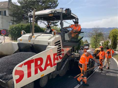
The same went for the paving of the new road surface. Both the pavers and compactors got their information on the required design. This allowed for a smooth road with high ridability and an optimised compaction workflow. Keeping track of pass counts, the density of compaction as well as the temperature of the surface, the compactors helped make sure the work was on-spec and the right data went into the final as-built model. Progress and quality in the field was furthermore constantly checked in a Field2BIM set up by surveyors using both Trimble GNSS receivers with tablets and a total station with a data collector.
Using mobile mapping
To close off the project, Strabag used its Trimble MX9 mobile mapping system to encapsulate the as-built situation of the Schiedhaldensteig road. With this final layer draped over the model, the Küsnacht municipality has a 100% accurate digital twin of this stretch of road which they will use for operations and maintenance.
“For all parties involved this was a great learning experience,” says Ljubicic. “For the excavator operators, who needed to rely fully on the technology instead of getting out of the cabin to measure points, for the utilities company workers who were at first apprehensive of not having any paper drawings to go by, and for the municipality officials, who closely followed the project through weekly as-built model compilations.”
He added that, “Partnership and transparency were really the key words on this project. Everyone involved always had access to all of the relevant data during the construction process. And even the local residents could get an up-to-date status report of the works from a dedicated web site accessible via QR codes to get a clear understanding of what to expect in terms of inconvenience from the work conducted in their street. Our 5D BIM approach really gives 360 degree visibility.”
STAY CONNECTED


Receive the information you need when you need it through our world-leading magazines, newsletters and daily briefings.
CONNECT WITH THE TEAM