


New partnership to simplify drone surveying

15 June 2022
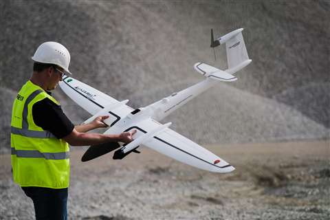 (Photo: Quantum-Systems)
Propeller Aero and Quantum-Systems have announced a partnership that will enable Propeller’s site surveying and 3D mapping software to work with Quantum-Systems’ Trinity F90+ drone.
Propeller’s Post-Processed Kinematic solution (PPK) enables surveying and 3D mapping of worksites across the construction, mining and earthworks industries. The Quantum-Systems’ Trinity F90+ drone is said to enable contractors to improve survey accuracy, condense their data collection process, and quickly share digital models among their broader worksite teams.
The company says that the combined solution will allow surveyors to place Propeller AeroPoints (smart ground control points) around the worksite, fly the Trinity F90+ drone above to collect survey data and upload that data to Propeller’s cloud-based platform where it is processed and available to use within 24 hours.
“Today’s contractors and surveyors are eager to adopt new technologies that modernise workflows and allow them to analyze more aspects of their worksite than ever before,” said Richie Hadfield, Head of Product at Propeller Aero.
“Our new partnership with Quantum-Systems gives our customers in Europe and around the world even more ways to achieve this increased efficiency and accuracy with the highly advanced F90+ drone.”
STAY CONNECTED


Receive the information you need when you need it through our world-leading magazines, newsletters and daily briefings.
CONNECT WITH THE TEAM